1 Location Big Data
Supported by environmental & geospatial big datasets from multiple sources.

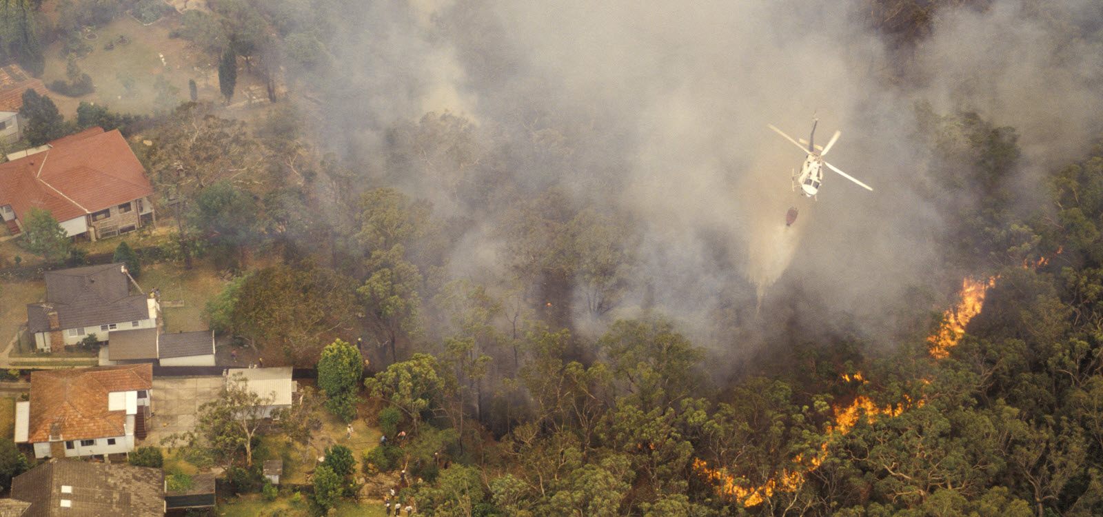
Natural Hazards
Applications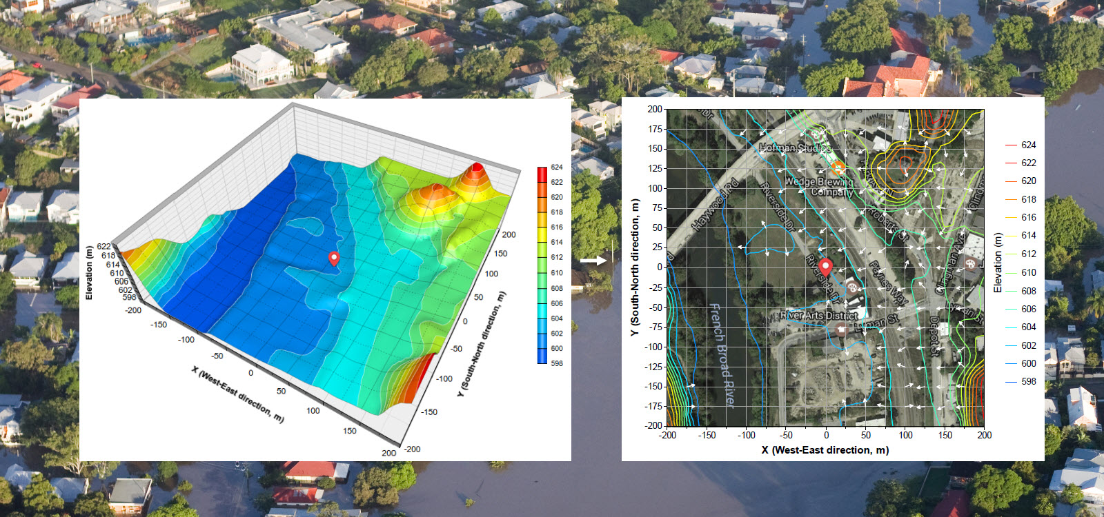
(This is a product website of BigData Earth)
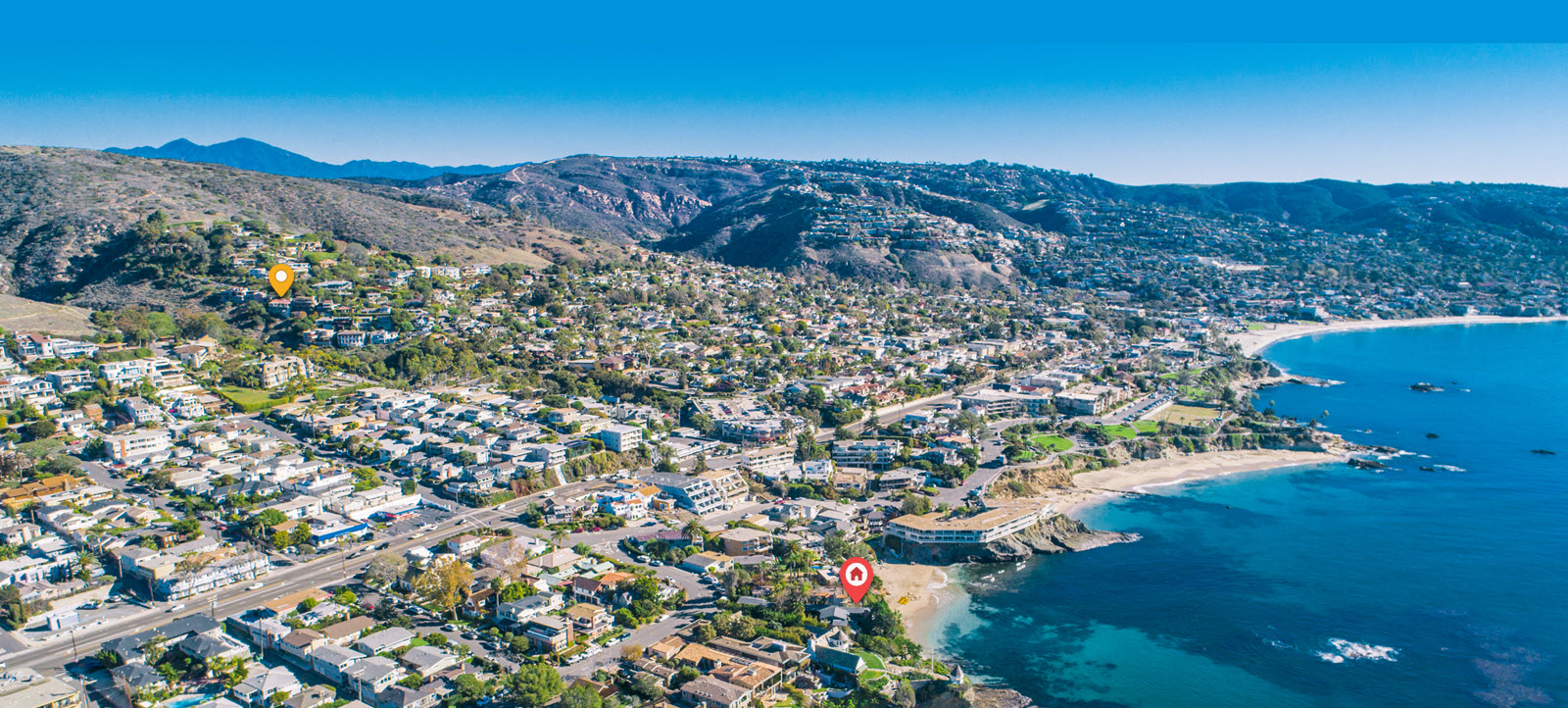
Location, location, location - For applications such as asset management, emergency planning & response, insurance underwriting & claims, news reporting, real estate, etc., the location information on the environment, hazard, exposure and risk is among the most important. We develop cloud-based big data analytics and solutions, and rapidly produce property location profile reports (e.g. in easy-to-read PDF) and perform risk analysis for addresses / sites in the Contiguous United States (CONUS, including 48 States) and worldwide.
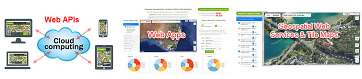
Integrated information products are efficiently delivered via web APIs, web Apps and web services (link to Developer Portal).
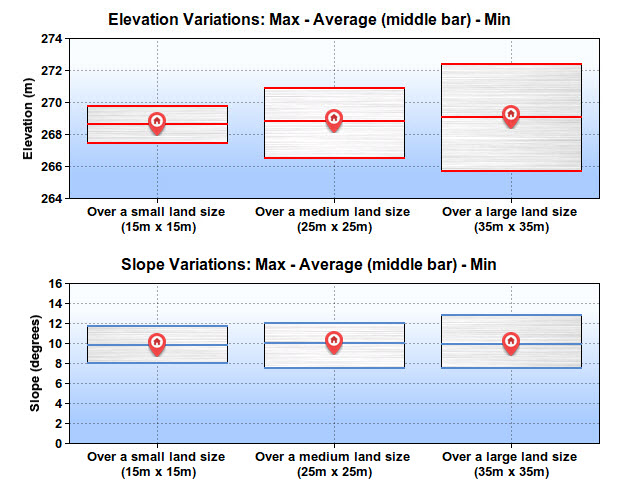
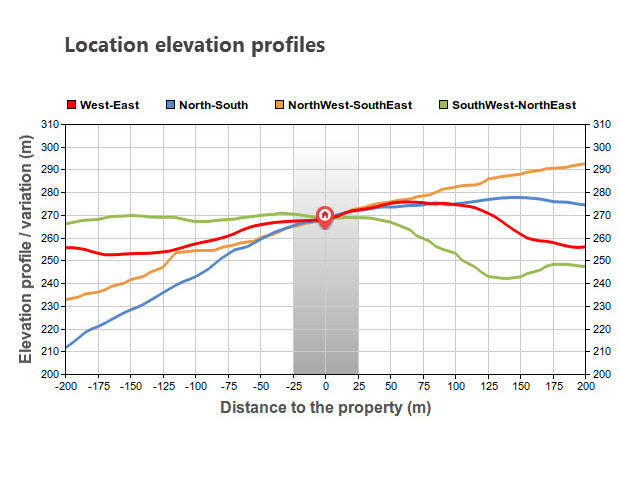
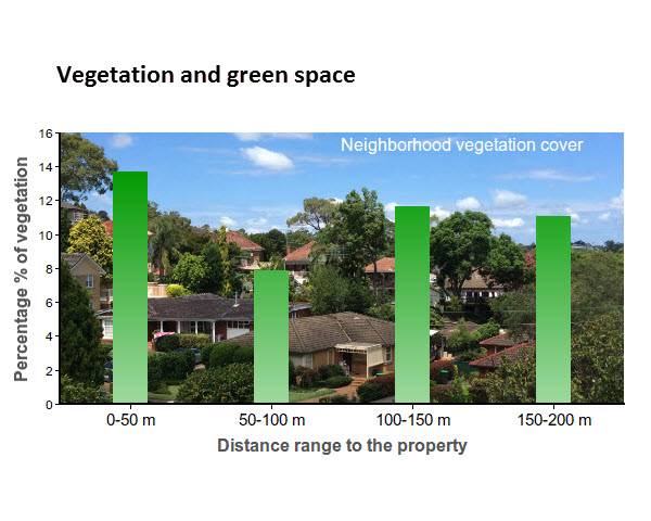
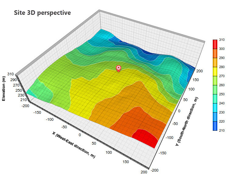
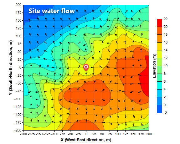
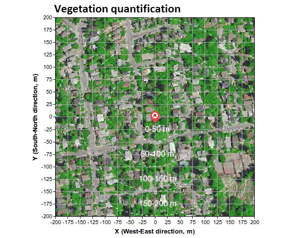
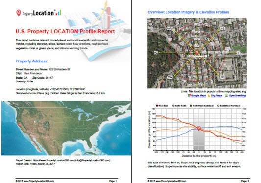
At a site level, we analyse and report a wide range of (50+) location-specific environmental metrics - elevation, slope, contours, surface water flow directions, vegetation & neighbourhood green space, weather, climate-warming trend, hazard, exposure, risk, etc. (Enhanced features related to specific domain fields can be added upon request.) We build geospatial big data & analytics platforms and use automation & optimization to scale up the above to have national coverage.
Supported by environmental & geospatial big datasets from multiple sources.
Elevation, terrain, land cover, climate change, hazard, exposure, risk, etc.
High-resolution satellite and aerial imagery provides a great location context.
Data integration, terrain & geospatial analysis for location insights and intelligence.
Advanced image analysis, feature extraction and land cover classification.
Easy-to-read maps and graphs helping users understand specific locations quickly.
A wide range of location-specific attributes are being developed and quantified to assist you to make informed location decisions when needed.
A wide range of location-specific attributes are being developed and measured to assist you to make informed location decisions when needed.
Many location-specific attributes are being developed and quantified to assist you to make informed location decisions when needed.
A few address-level examples (maps and graphs) are included below.
Easy-to-read PDF report (file size ~3MB)
This sample report is based on a typical suburb address. Reports for your address / site will be in the same format.
If your questions are not covered here, please contact us.
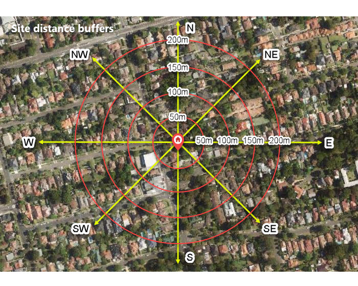
For all locations in the Contiguous United States (including 48 states): reporting at a site level within a radius of 200m; for worldwide locations: default reporting within a radius of 1,200m. Detailed reporting for any specific area may be requested by clients.
It depends on the amount and the type of digital content requested. Typically, it's within seconds (1-10 seconds). Reports and animations, or individual parts contained, are rapidly generated and delivered (via web APIs, downloads and emails) in an automated manner. In case of unexpected issues, we will try to solve them within 24-48 hours.
Automatically: For businesses wishing to request reports at scale, please refer to our Location Profile APIs. Manually: Please use our web mapping, analysis and reporting Apps. Typically, four fields (email, client ID, latitude and longitude) are needed.
Our Location Profile APIs are application-oriented, especially related to property location and hazard risk. A simple API call can return a set of integrated metrics in various accessible forms, including PDF report (up to 40+ pages), chart, image and animation. Our APIs provide location analytics, contextual insights and flexible reporting on the fly.
We are a small agile team based in Sydney, Australia, with strong Research & Development experiences serving worldwide clients across various private and public sectors, ranging from real estate to insurance, from asset management to government agencies.
After integrating many authoritative and high-quality data sources (mostly open data) from government agencies and the scientific community, we perform geospatial big data analytics, environmental modelling and advanced image processing in order to generate address-level reports with rich contextual insights and actionable location intelligence.
This website has an alias: GeoRisk360.com We are part of BigData Earth Pty Ltd. If you are interested in our offerings or have any questions, please do not hesitate to contact us. We will try to get back to you as soon as we can.