- Coverage:
The U.S. & Worldwide - Email:
info@PropertyLocation360.com Location Profile APIs Available
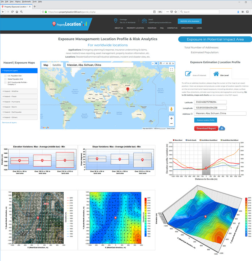
API-enabled Property Location Profile Report & Risk Analytics |
For worldwide locations |
Applications: Property location information, emergency, insurance, asset management, news media, etc. Locations: Residential/commercial/industrial addresses, incident & disaster sites, etc.Reporting with a site radius of 1,200m & analysis report delivered in seconds via web APIs, downloads and emails04/2018: Version 4.3, A major exposure estimation component incorporated | 08/2017: Related news release January 2019: New web mapping, analysis and reporting App  11/2018 Typhoon Yutu (Rosita) - SE Asia: Satellite imagery, exposure & location profile report 09/2018 Typhoon Mangkhut - SE Asia: Satellite imagery, exposure & location profile report 08/2018 Major Flooding in Kerala, India: Satellite imagery & flood extent 07/2018 Wildfires in Mati and Kineta, Greece: Satellite imagery & climate-warming trend report 07/2018 Major Flooding, Japan: Satellite imagery, modelled flood-prone areas & location profile report 07/2018 Massive Wildfires in Siberia, Russia: Satellite imagery 06/2018 Saddleworth Moor Fire in Manchester, the UK: Satellite imagery & location profile report 05/2018 Eruption from the Kilauea Volcano, Hawaii: Satellite imagery | Location profile report for an affected site 02/2018 Volcán de Fuego Eruption, Guatemala: Satellite imagery | Location profile report 01/2018 Mount Mayon Volcano Eruption, the Philippines: Satellite imagery | 3D visualisation | Location profile report 11/2017 Mount Agung Volcano Eruption, Indonesia: Location profile report 08/2017 Landslide, Sierra Leone: Location profile report 07/2017 Floods, Japan: Location profile report 06/2017 Landslide, China: Location profile report 06/2017 Wildfires, Portugal: Location profile report 03/2017 Floods, Australia: Location profile report |
|
| Access to an earlier version for report request |